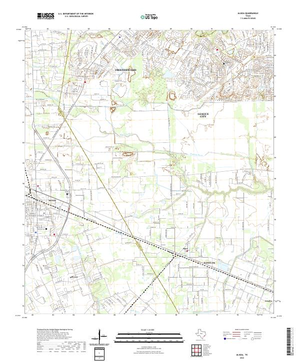
2022 Map of Algoa
USGS Topo · Published 2022About this map
Alvin and its surroundings serve as a central hub in this modern coastal Texas landscape, where the intersections of drainage and development define the terrain. The map traces the winding paths of Dickinson Bayou and Mustang Bayou, which cut through the residential expansions of Friendswood and League City. Local history is anchored by sites like Confederate Cem and Oak Park Cem, while the industrial and agricultural water management is evidenced by the American Canal traversing the western edge of the quadrangle. The presence of Alvin Community College and the specialized Alvin Byp transit corridor reflect the region's contemporary infrastructure. Further south, the settlements of Algoa and Santa Fe maintain a more linear grid pattern, separated from the northern suburban growth by a network of bayous and creeks including Halls Bayou and Chigger Cr.
Find a feature on this map
104 named features on this map. Tap any name to fly to it.
Don’t see what you’re looking for? This feature index may not catch every label — zoom into the map to look around manually.
Map Details
Editions of this 2022 Algoa Map
This is the sole edition of this map. No revisions or reprints were ever made.
Other maps of this area

1916 · Genoa
USGS Topo · 1:24,000

1916 · Seabrook
USGS Topo · 1:24,000

1920 · Seabrook
USGS Topo · 1:31,680

1920 · Genoa
USGS Topo · 1:31,680

1920 · Mykawa
USGS Topo · 1:31,680

1929 · Dickinson
USGS Topo · 1:24,000

1929 · Algoa
USGS Topo · 1:24,000

1929 · Hitchcock
USGS Topo · 1:24,000

1932 · Algoa
USGS Topo · 1:31,680
1932 · Genoa
USGS Topo · 1:31,680