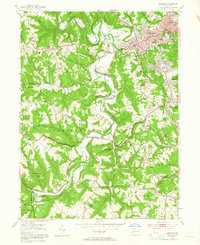
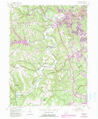
1954 Map of Aliquippa
USGS Topo · Published 1965About this map
Aliquippa and its surrounding townships in the mid-1950s reveal a landscape transitioning from rural valleys to concentrated industrial-era suburban growth. The urban core near the top of the map contrasts sharply with the winding course of Raccoon Creek and the expansive greenery of the Pennsylvania Game Commission lands and Raccoon Creek State Park to the southwest. This era of development is marked by the presence of the Aliquippa Airport and the Drive-in Theater, symbols of post-war mobile culture alongside older foundations like the John Anderson Memorial Cem and Service United Ch.
Find a feature on this map
53 named features on this map. Tap any name to fly to it.
Don’t see what you’re looking for? This feature index may not catch every label — zoom into the map to look around manually.
Map Details
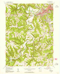
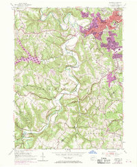
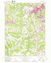
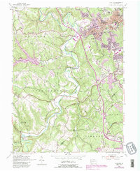
Editions of this 1954 Aliquippa Map
6 editions found
Other maps of this area

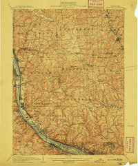
1901 · Beaver
USGS Topo · 1:62,500

1904 · Beaver
USGS Topo · 1:62,500

1904 · Carnegie
USGS Topo · 1:62,500

1904 · Burgettstown
USGS Topo · 1:62,500

1906 · Burgettstown
USGS Topo · 1:62,500

1906 · Carnegie
USGS Topo · 1:62,500

1906 · Sewickley
USGS Topo · 1:62,500
1908 · Sewickley
USGS Topo · 1:62,500

1908 · Carnegie
USGS Topo · 1:62,500

1951 · Canton
USGS Topo · 1:250,000
Featured Places
- Moon Township, PA
- Center Township, PA
- Aliquippa, PA
- Independence Township, PA
- Bocktown, Independence Township