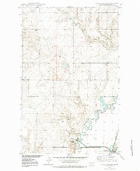
1948 Map of Alkali Coulee
USGS Topo · Published 1985About this map
Big Muddy Creek meanders sharply through this northeastern Montana landscape, marking a transition between the open prairie and the established boundaries of the Fort Peck Indian Reservation. In the southeastern corner, the town of Medicine Lake serves as a small rail hub along the Great Northern railroad line, situated adjacent to the protected waters of the Medicine Lake National Wildlife Refuge.
Find a feature on this map
16 named features on this map. Tap any name to fly to it.
Don’t see what you’re looking for? This feature index may not catch every label — zoom into the map to look around manually.
Map Details
Editions of this 1948 Alkali Coulee Map
3 editions found
Other maps of this area

1914 · Homestead
USGS Topo · 1:62,500

1947 · Homestead
USGS Topo · 1:24,000

1948 · Homestead
USGS Topo · 1:24,000

1948 · Medicine Lake
USGS Topo · 1:24,000

1948 · Reserve
USGS Topo · 1:24,000

1948 · Alkali Coulee
USGS Topo · 1:24,000

1948 · Antelope
USGS Topo · 1:24,000

1949 · Reserve
USGS Topo · 1:24,000

1949 · Antelope
USGS Topo · 1:24,000

1949 · Alkali Coulee
USGS Topo · 1:24,000