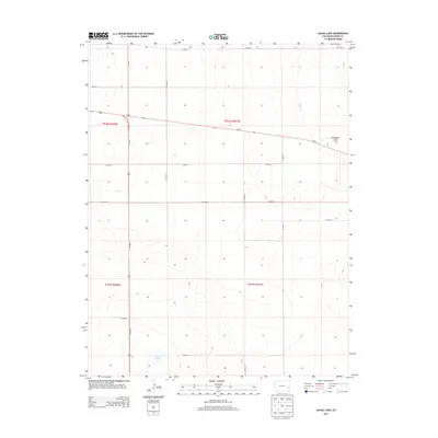
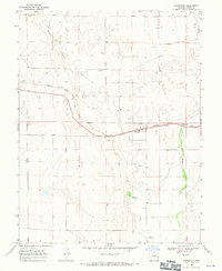
2013 Map of Alkali Lake
USGS Topo · Published 2013About this map
Alkali Lake sits in the southern portion of this high plains landscape in Kiowa County, providing a singular hydrological focal point in an otherwise arid region of Eastern Colorado. The terrain is characterized by subtle elevation shifts, most notably at Chivington Hill in the northeast. The map illustrates a rigid rectangular survey system typical of the American West, where a network of local roads such as Co Road N and Co Road P divide the land into distinct sections. Major transit corridors intersect here, with the north-south route of Us-287 N and Us-287 S crossing the path of Co-96. This convergence of state and federal highways suggests the area's role as a persistent thoroughfare for travelers moving between the Arkansas River Valley and the northern plains.
Find a feature on this map
19 named features on this map. Tap any name to fly to it.
Don’t see what you’re looking for? This feature index may not catch every label — zoom into the map to look around manually.
Map Details
Editions of this 2013 Alkali Lake Map
This is the sole edition of this map. No revisions or reprints were ever made.
Other maps of this area

1891 · Kit Carson
USGS Topo · 1:125,000

1892 · Lamar
USGS Topo · 1:125,000

1893 · Kit Carson
USGS Topo · 1:125,000

1954 · Lamar
USGS Topo · 1:250,000

1958 · Lamar
USGS Topo · 1:250,000

1967 · Neenoshe Reservoir
USGS Topo · 1:24,000
1968 · Alkali Lake
USGS Topo · 1:24,000
1968 · Chivington SE
USGS Topo · 1:24,000
1968 · Swede Lake
USGS Topo · 1:24,000
1968 · Chivington
USGS Topo · 1:24,000