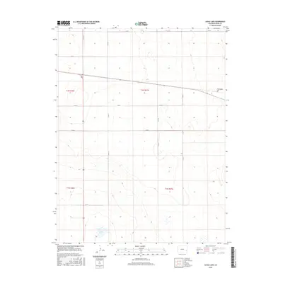
2016 Map of Alkali Lake
USGS Topo · Published 2016About this map
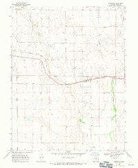
Alkali Lake occupies the southwestern corner of this survey, a seasonal water feature in a landscape defined by an orderly grid of section lines and township boundaries. The terrain is characterized by gentle undulations and scattered depressions, with Chivington Hill rising as a prominent high point in the northeastern sector. This portion of the high plains remains primarily organized for agricultural and ranching use, evidenced by the extensive network of numbered and lettered county roads, including Co RD T and Co RD 43, which delineate the terrain into traditional mile-square sections. The map provides a precise view of the rural infrastructure in Kiowa County, showing how the Public Land Survey System continues to dictate the local geography through boundaries like t18s r48w and t19s r47w.
Find a feature on this map
16 named features on this map. Tap any name to fly to it.
Don’t see what you’re looking for? This feature index may not catch every label — zoom into the map to look around manually.
Map Details
Editions of this 2016 Alkali Lake Map
This is the sole edition of this map. No revisions or reprints were ever made.
Other maps of this area

1891 · Kit Carson
USGS Topo · 1:125,000

1892 · Lamar
USGS Topo · 1:125,000

1893 · Kit Carson
USGS Topo · 1:125,000

1954 · Lamar
USGS Topo · 1:250,000

1958 · Lamar
USGS Topo · 1:250,000

1967 · Neenoshe Reservoir
USGS Topo · 1:24,000
1968 · Alkali Lake
USGS Topo · 1:24,000
1968 · Chivington SE
USGS Topo · 1:24,000
1968 · Swede Lake
USGS Topo · 1:24,000
1968 · Chivington
USGS Topo · 1:24,000