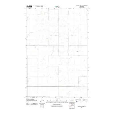
2011 Map of Alkaline Lake SW
USGS Topo · Published 2011About this map
Salem Cemetery serves as a primary historical waypoint in this portion of Logan County, situated within a landscape defined by an intricate network of small wetlands and ephemeral basins. The area is organized by a precise grid of section-line roads, including 32nd Ave SE and 35th Ave SE, reflecting the systematic land division of the North Dakota prairie. Toward the southern edge of the quadrangle, Lake Ave E and 63rd St SE provide access through the undulating terrain. This 2011 survey by the U.S. Geological Survey illustrates the intersection of rural infrastructure and the natural hydrology of the Missouri Coteau region, where countless small water bodies dictate the placement of farms and transit routes.
Find a feature on this map
16 named features on this map. Tap any name to fly to it.
Don’t see what you’re looking for? This feature index may not catch every label — zoom into the map to look around manually.
Map Details
Editions of this 2011 Alkaline Lake SW Map
This is the sole edition of this map. No revisions or reprints were ever made.
Other maps of this area

1953 · Jamestown
USGS Topo · 1:250,000

1956 · Jamestown
USGS Topo · 1:250,000

1979 · Kintyre NE
USGS Topo · 1:24,000

1979 · McKenna Lake South
USGS Topo · 1:24,000

1980 · McKenna Lake North
USGS Topo · 1:24,000

1982 · Wishek NE
USGS Topo · 1:24,000

1982 · Burnstad
USGS Topo · 1:24,000

1983 · Alkaline Lake SW
USGS Topo · 1:24,000

1983 · Alkaline Lake
USGS Topo · 1:24,000

1983 · Alkaline Lake NW
USGS Topo · 1:24,000