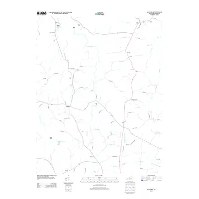
2013 Map of Allegre
USGS Topo · Published 2013About this map
Mount Tabor and the surrounding rural communities of Todd County are meticulously documented in this 2013 survey, highlighting a landscape defined by small settlements and family-named cemeteries. The drainage patterns of the Pond River and its numerous tributaries, such as Slim Jimmy Br and Sulfur Lick, shape the topography of the region. Local history is deeply embedded in the land, with several family burial grounds including Slaughter Cem, Edwards Cem, and Kirkman Cem scattered across the quadrangle. The settlement of Allegre serves as a central point for local road networks like Rager Rd and W Hall Rd. Further south, the map identifies evocative terrain features like Happy Hollow and Dead Man Hollow, suggesting the local lore and physical character of the Kentucky countryside during this era.
Find a feature on this map
84 named features on this map. Tap any name to fly to it.
Don’t see what you’re looking for? This feature index may not catch every label — zoom into the map to look around manually.
Map Details
Editions of this 2013 Allegre Map
This is the sole edition of this map. No revisions or reprints were ever made.
Other maps of this area

1911 · Drakesboro
USGS Topo · 1:48,000

1912 · Nortonville
USGS Topo · 1:62,500

1913 · Drakesboro
USGS Topo · 1:62,500

1950 · Pembroke
USGS Topo · 1:24,000

1950 · Olmstead
USGS Topo · 1:24,000

1951 · Pembroke
USGS Topo · 1:24,000

1951 · Elkton
USGS Topo · 1:24,000

1951 · Olmstead
USGS Topo · 1:24,000

1952 · Sharon Grove
USGS Topo · 1:24,000

1952 · Allegre
USGS Topo · 1:24,000