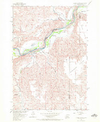
1956 Map of Alleman Station
USGS Topo · Published 1972About this map
The Cheyenne River winds through this mid-century landscape, marking the natural boundary between Ziebach and Haakon counties. The map records a critical moment for the river valley, as dashed blue patterns indicate vast areas destined for submergence by the Oahe Reservoir project, including bottomlands near Carlin Bridge and Alleman Station. High above the floodplain, the plateau is dominated by expansive terrain such as Circle P Flats and Mississippi Flats.
Find a feature on this map
19 named features on this map. Tap any name to fly to it.
Don’t see what you’re looking for? This feature index may not catch every label — zoom into the map to look around manually.
Map Details
Editions of this 1956 Alleman Station Map
3 editions found
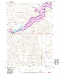
Other maps of this area

1954 · Pierre
USGS Topo · 1:250,000

1956 · Kirley
USGS Topo · 1:24,000

1956 · Carlin Flat
USGS Topo · 1:24,000

1956 · Alleman Station
USGS Topo · 1:24,000

1956 · Herbert Creek SE
USGS Topo · 1:24,000

1956 · Sansarc NE
USGS Topo · 1:24,000

1958 · Pierre
USGS Topo · 1:250,000

1981 · Herbert Creek SW
USGS Topo · 1:24,000

1981 · High Elk Hill SE
USGS Topo · 1:24,000

1982 · Sansarc
USGS Topo · 1:24,000