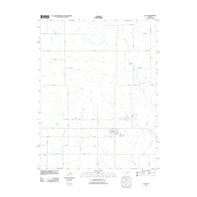
2012 Map of Allen
USGS Topo · Published 2012About this map
Allen sits at the heart of this Lyon County landscape, where the town's street grid—including E 7th St and Wiser St—is surrounded by a network of rural section roads and winding watercourses. The local hydrology is defined by the uniquely named One Hundred and Fortytwo Mile Creek, along with Bluff Creek, Allen Creek, and Hill Creek. For genealogists and local historians, the area is anchored by the Allen Cemetery just east of town and the Bushong Cemetery to the southwest. The presence of the Admire-Allen City Lake and numerous small stock ponds across the terrain highlights the region's agricultural dependency and water management practices in the early 21st century.
Find a feature on this map
39 named features on this map. Tap any name to fly to it.
Don’t see what you’re looking for? This feature index may not catch every label — zoom into the map to look around manually.
Map Details
Editions of this 2012 Allen Map
This is the sole edition of this map. No revisions or reprints were ever made.
Other maps of this area

1885 · Eskridge
USGS Topo · 1:125,000

1889 · Eskridge
USGS Topo · 1:125,000

1894 · Eskridge
USGS Topo · 1:125,000

1955 · Hutchinson
USGS Topo · 1:250,000

1959 · Hutchinson
USGS Topo · 1:250,000
1971 · Admire
USGS Topo · 1:24,000

1971 · Alta Vista SE
USGS Topo · 1:24,000

1971 · Allen
USGS Topo · 1:24,000

1971 · Bushong
USGS Topo · 1:24,000
1971 · Lake Wabaunsee
USGS Topo · 1:24,000