
1971 Map of Allen
USGS Topo · Published 1973About this map
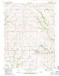
The town of Allen serves as the focal point of this rural Kansas survey, situated along the Missouri Pacific railroad line. The landscape is a study in transitional transport, showing the intersection of rail infrastructure with the modern Kansas Turnpike cutting through the southeastern corner. A significant historical marker, the Indian Treaty Boundary, runs north-to-south through Agnes City township, providing a clear cartographic link to the region's 19th-century land divisions. Local civic life is anchored by the Admire-Allen City Lake and Northern Heights High Sch, while numerous quarries and cemeteries like Allen Cem and Bushong Cem dot the terrain. Waterways such as One Hundred and Forty-two Mile Creek and Bluff Creek drain the undulating prairie, illustrating the drainage patterns that shaped early settlement in Lyon and Wabaunsee counties.
Find a feature on this map
20 named features on this map. Tap any name to fly to it.
Don’t see what you’re looking for? This feature index may not catch every label — zoom into the map to look around manually.
Map Details
Editions of this 1971 Allen Map
2 editions found
Other maps of this area

1885 · Eskridge
USGS Topo · 1:125,000

1889 · Eskridge
USGS Topo · 1:125,000

1894 · Eskridge
USGS Topo · 1:125,000

1955 · Hutchinson
USGS Topo · 1:250,000

1959 · Hutchinson
USGS Topo · 1:250,000
1971 · Admire
USGS Topo · 1:24,000

1971 · Alta Vista SE
USGS Topo · 1:24,000

1971 · Bushong
USGS Topo · 1:24,000
1971 · Lake Wabaunsee
USGS Topo · 1:24,000
1971 · Eskridge
USGS Topo · 1:24,000