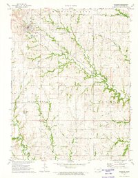
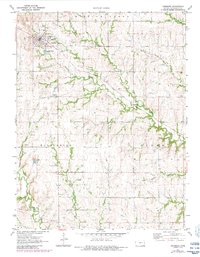
1971 Map of Eskridge
USGS Topo · Published 1974About this map
The town of Eskridge sits as the primary hub in this early 1970s landscape, defined by its position along the Atchison Topeka and Santa Fe railroad line. The surrounding rural landscape in Wilmington and Plumb townships is heavily marked by energy and resource extraction, featuring an active Oil Field, numerous Oil Wells, and a regional Pipeline network. Beyond the town grid, the terrain is carved by a dense network of waterways including Dragoon Creek, Soldier Creek, and the headwaters of the Wakarusa R. For local historians, the presence of the Eskridge Cem and the smaller settlement at Bradford provide specific points of interest for tracing family sites and land use. The map also reveals industrial activity through several Quarry sites near Hungry Hollow, reflecting the area's reliance on both the soil and the sub-surface minerals.
Find a feature on this map
23 named features on this map. Tap any name to fly to it.
Don’t see what you’re looking for? This feature index may not catch every label — zoom into the map to look around manually.
Map Details
Editions of this 1971 Eskridge Map
2 editions found
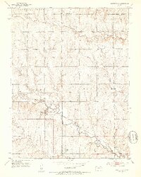
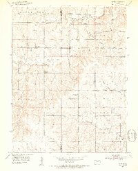
Other maps of this area

1885 · Eskridge
USGS Topo · 1:125,000

1889 · Burlingame
USGS Topo · 1:125,000

1889 · Eskridge
USGS Topo · 1:125,000

1894 · Eskridge
USGS Topo · 1:125,000

1894 · Burlingame
USGS Topo · 1:125,000

1947 · Lawrence
USGS Topo · 1:250,000

1950 · Lawrence
USGS Topo · 1:250,000
1952 · Harveyville
USGS Topo · 1:24,000
1952 · Dover
USGS Topo · 1:24,000

1955 · Hutchinson
USGS Topo · 1:250,000