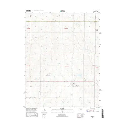
2015 Map of Allen
USGS Topo · Published 2015About this map
Allen and the surrounding Lyon County prairie lands are defined by a network of rural routes and winding waterways. This 2015 U.S. Geological Survey representation captures the settlement pattern along the Wabaunsee Co Lyon Co border, where the town of Bushong sits to the southwest. The landscape is carved by numerous drainages, most notably the uniquely named One Hundred and Forty-two Mile Cr in the northeast and Allen Cr to the west. Local infrastructure is anchored by the Admire-Allen City Lake and the Allen Cem, while the township grid is maintained by a series of numbered roads like Rd 400 and Rd 330. The topography reveals the subtle elevation changes of the Flint Hills region, with drainage systems like Hill Cr and Duck Cr directing the flow of water across this agricultural expanse.
Find a feature on this map
25 named features on this map. Tap any name to fly to it.
Don’t see what you’re looking for? This feature index may not catch every label — zoom into the map to look around manually.
Map Details
Editions of this 2015 Allen Map
This is the sole edition of this map. No revisions or reprints were ever made.
Other maps of this area

1885 · Eskridge
USGS Topo · 1:125,000

1889 · Eskridge
USGS Topo · 1:125,000

1894 · Eskridge
USGS Topo · 1:125,000

1955 · Hutchinson
USGS Topo · 1:250,000

1959 · Hutchinson
USGS Topo · 1:250,000
1971 · Admire
USGS Topo · 1:24,000

1971 · Alta Vista SE
USGS Topo · 1:24,000

1971 · Allen
USGS Topo · 1:24,000

1971 · Bushong
USGS Topo · 1:24,000
1971 · Lake Wabaunsee
USGS Topo · 1:24,000