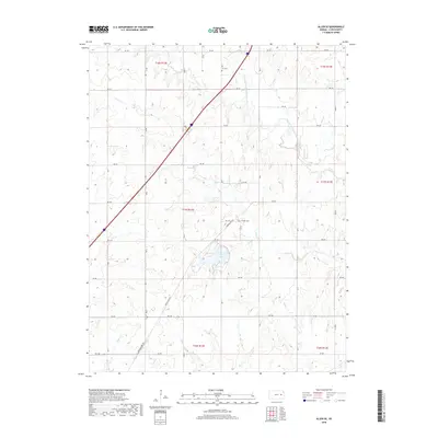
2018 Map of Allen SE
USGS Topo · Published 2018About this map
Lyon County State Lake sits as a central landmark in this portion of Kansas, surrounded by a complex network of prairie drainage. The landscape is defined by the winding paths of several watercourses, most notably the remarkably named One Hundred and Fortytwo Mile Creek and Duck Creek. Transportation across this section of Lyon County is dictated by a rigid grid of rural roads, though the diagonal path of Burlingame Road cuts through the township boundaries. Local history is anchored by small, isolated burial sites such as Ivy Cem in the north and Phillips Cem to the east of the lake. These features, along with several creeks like Badger Creek and Taylor Creek, illustrate a rural environment where land use is closely tied to the natural hydrology and the established section lines of the Public Land Survey System.
Find a feature on this map
31 named features on this map. Tap any name to fly to it.
Don’t see what you’re looking for? This feature index may not catch every label — zoom into the map to look around manually.
Map Details
Editions of this 2018 Allen SE Map
This is the sole edition of this map. No revisions or reprints were ever made.
Other maps of this area

1885 · Eskridge
USGS Topo · 1:125,000

1885 · Burlington
USGS Topo · 1:125,000

1888 · Emporia
USGS Topo · 1:125,000

1889 · Burlingame
USGS Topo · 1:125,000

1889 · Eskridge
USGS Topo · 1:125,000

1894 · Emporia
USGS Topo · 1:125,000

1894 · Eskridge
USGS Topo · 1:125,000

1894 · Burlingame
USGS Topo · 1:125,000

1894 · Burlington
USGS Topo · 1:125,000

1947 · Lawrence
USGS Topo · 1:250,000