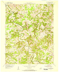
1954 Map of Allen Springs
USGS Topo · Published 1956About this map
The winding Trammel Fork anchors this rural landscape across the border of Warren and Allen Counties in the mid-1950s. Small community centers such as Alvaton, Allen Springs, and Butlersville are defined by a dense network of country roads connecting local landmarks. The map reveals a high concentration of institutional sites essential to mid-century rural life, including numerous churches like Shiloh Ch and Old Liberty Ch, alongside educational hubs like Mt Pleasant Sch.
Find a feature on this map
33 named features on this map. Tap any name to fly to it.
Don’t see what you’re looking for? This feature index may not catch every label — zoom into the map to look around manually.
Map Details
Editions of this 1954 Allen Springs Map
2 editions found
Other maps of this area

1921 · Bowling Green
USGS Topo · 1:62,500

1923 · Bowling Green
USGS Topo · 1:62,500

1926 · Scottsville
USGS Topo · 1:62,500

1928 · Adolphus
USGS Topo · 1:48,000

1931 · Lafayette
USGS Topo · 1:62,500

1931 · Adolphus
USGS Topo · 1:62,500

1942 · Gallatin
USGS Topo · 1:100,000

1954 · Drake
USGS Topo · 1:24,000

1954 · Petroleum
USGS Topo · 1:24,000
1954 · Polkville
USGS Topo · 1:24,000