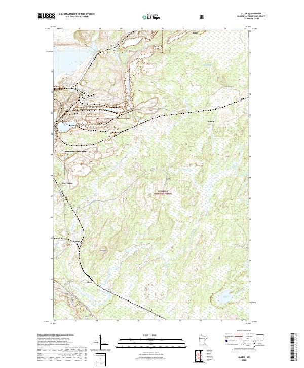
2022 Map of Allen
USGS Topo · Published 2022About this map
The Mesabi Range defines the northern landscape of this region in St. Louis County, where the transition from industrial resource extraction to wilderness is clearly marked. Significant mining-related features like Spring Mine Lake and the Dunka Mine Road intersect with the vast, undeveloped wetlands of the One Hundred Mile Swamp. The settlement of Allen serves as a central point for local transportation, connected by the Allen Juntion Road and several recreational paths, including the Seven Beavers Trl and Bird Lake Trl. Much of the eastern and central portion of the map is protected within the Superior National Forest, highlighting the area's dual identity as both a productive iron range and a conservation corridor. Waterways such as the Partridge River and Cranberry Cr drain the lowlands, while Moose Mtn provides a distinct change in elevation south of the primary range.
Find a feature on this map
29 named features on this map. Tap any name to fly to it.
Don’t see what you’re looking for? This feature index may not catch every label — zoom into the map to look around manually.
Map Details
Editions of this 2022 Allen Map
This is the sole edition of this map. No revisions or reprints were ever made.
Other maps of this area

1949 · Aurora
USGS Topo · 1:24,000

1949 · Isaac Lake
USGS Topo · 1:24,000

1949 · Allen
USGS Topo · 1:24,000

1949 · Embarrass
USGS Topo · 1:24,000

1950 · Isaac Lake
USGS Topo · 1:24,000

1950 · Embarrass
USGS Topo · 1:24,000

1950 · Allen
USGS Topo · 1:24,000

1950 · Aurora
USGS Topo · 1:24,000

1951 · Babbitt SW
USGS Topo · 1:24,000

1951 · Babbitt
USGS Topo · 1:24,000