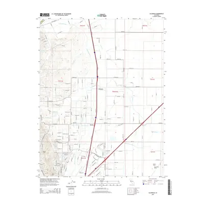
2015 Map of Allendale
USGS Topo · Published 2015About this map
English Hills rise above the western edge of this 2015 survey, marking the transition from upland terrain to the flat expanse of the Sacramento Valley. The landscape is defined by its water management and transportation corridors, most notably the Putah South Canal which winds through the central part of the quadrangle. Small settlements like Allendale and Hartley sit along a grid of rural roads, including Allendale Rd and Winters Rd, illustrating the region's agricultural character near the boundary of the Central Valley.
Find a feature on this map
143 named features on this map. Tap any name to fly to it.
Don’t see what you’re looking for? This feature index may not catch every label — zoom into the map to look around manually.
Map Details
Editions of this 2015 Allendale Map
This is the sole edition of this map. No revisions or reprints were ever made.
Other maps of this area

1902 · Napa
USGS Topo · 1:125,000

1907 · Woodland
USGS Topo · 1:62,500

1908 · Vacaville
USGS Topo · 1:62,500

1915 · Merritt
USGS Topo · 1:31,680

1916 · Dixon
USGS Topo · 1:31,680

1916 · Winters
USGS Topo · 1:31,680

1916 · Maine Prairie
USGS Topo · 1:31,680

1917 · Wolfskill
USGS Topo · 1:31,680

1917 · Elmira
USGS Topo · 1:31,680

1921 · Mt. Vaca
USGS Topo · 1:62,500