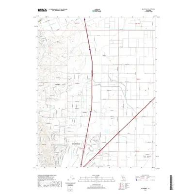
2018 Map of Allendale
USGS Topo · Published 2018About this map
Vacaville anchors this 2018 survey, marking the transition from the rising slopes of the English Hills into the floor of the Sacramento Valley. The map highlights a complex network of water management and rural infrastructure, centered on the Putah South Canal as it winds through the agricultural landscape toward Leisure Town. This area showcases the evolution of Solano County's land use, where long-established landmarks like Olive School and Browns School stand alongside modern aviation facilities at Nut Tree Airport. The terrain is defined by numerous seasonal drainages, including Gibson Canyon Creek and Sweany Creek, which have historically shaped the settlement patterns of Allendale and Hartley. The grid of county roads, such as Winters Rd and Silveyville Rd, illustrates the enduring organization of this fertile corridor between the hills and the valley.
Find a feature on this map
180 named features on this map. Tap any name to fly to it.
Don’t see what you’re looking for? This feature index may not catch every label — zoom into the map to look around manually.
Map Details
Editions of this 2018 Allendale Map
This is the sole edition of this map. No revisions or reprints were ever made.
Other maps of this area

1902 · Napa
USGS Topo · 1:125,000

1907 · Woodland
USGS Topo · 1:62,500

1908 · Vacaville
USGS Topo · 1:62,500

1915 · Merritt
USGS Topo · 1:31,680

1916 · Dixon
USGS Topo · 1:31,680

1916 · Winters
USGS Topo · 1:31,680

1916 · Maine Prairie
USGS Topo · 1:31,680

1917 · Wolfskill
USGS Topo · 1:31,680

1917 · Elmira
USGS Topo · 1:31,680

1921 · Mt. Vaca
USGS Topo · 1:62,500