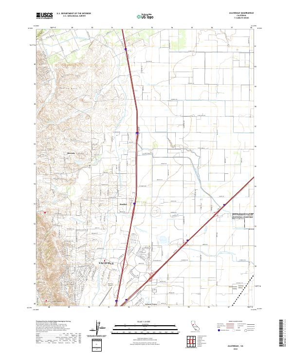
2022 Map of Allendale
USGS Topo · Published 2022About this map
The English Hills descend into the northern reach of Vacaville, marking a distinct topographical boundary where the rising slopes of the Vaca Valley meet the flat floor of the Sacramento Valley. This area is defined by its water management systems, notably the Putah South Canal which winds through the landscape to support the region's agricultural tradition. Several smaller watercourses, including Sweany Creek and Gibson Canyon Creek, drain the western hills toward the plains. The map details the transition from the established community of Allendale and the small settlement at Hartley to the growing residential patterns of Leisure Town. Transportation infrastructure is a central feature, anchored by the Nut Tree Airport and a dense network of country roads such as Winters Rd, Dixon Ave W, and Silveyville Rd that connect rural homesteads to the expanding urban centers.
Find a feature on this map
79 named features on this map. Tap any name to fly to it.
Don’t see what you’re looking for? This feature index may not catch every label — zoom into the map to look around manually.
Map Details
Editions of this 2022 Allendale Map
This is the sole edition of this map. No revisions or reprints were ever made.
Other maps of this area

1902 · Napa
USGS Topo · 1:125,000

1907 · Woodland
USGS Topo · 1:62,500

1908 · Vacaville
USGS Topo · 1:62,500

1915 · Merritt
USGS Topo · 1:31,680

1916 · Dixon
USGS Topo · 1:31,680

1916 · Winters
USGS Topo · 1:31,680

1916 · Maine Prairie
USGS Topo · 1:31,680

1917 · Wolfskill
USGS Topo · 1:31,680

1917 · Elmira
USGS Topo · 1:31,680

1921 · Mt. Vaca
USGS Topo · 1:62,500