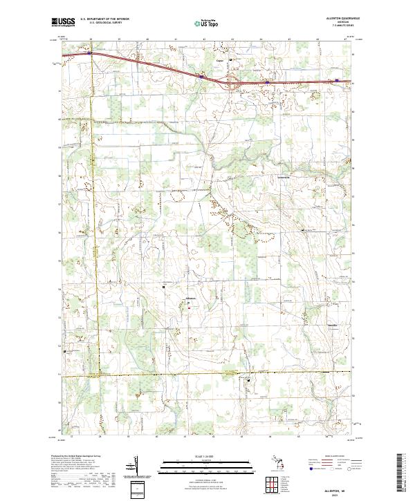
2023 Map of Allenton
USGS Topo · Published 2023About this map
Allenton and Berville anchor this rural landscape in the early 2020s, situated at the intersection of St. Clair, Lapeer, and Macomb counties. The terrain is defined by a dense network of agricultural drainage and natural waterways, including the Belle River and the East Branch Coon Creek. This modern survey reveals the persistence of early settlement patterns, with numerous historic burial sites such as the Scotch Settlement Cem and West Berlin Cem still preserved amidst the gridded section lines. The village of Capac sits at the northern edge, bordered by the Capac Drain and Capac Cem, marking a transition from the agricultural heartland toward the Interstate corridor. Researchers can trace the sophisticated water management systems like McKay Ditch and Newland Drain that have long supported the region's farming economy.
Find a feature on this map
52 named features on this map. Tap any name to fly to it.
Don’t see what you’re looking for? This feature index may not catch every label — zoom into the map to look around manually.
Map Details
Editions of this 2023 Allenton Map
This is the sole edition of this map. No revisions or reprints were ever made.
Other maps of this area

1914 · Armada
USGS Topo · 1:62,500

1928 · Armada
USGS Topo · 1:62,500

1943 · Romeo
USGS Topo · 1:24,000

1944 · Memphis
USGS Topo · 1:24,000

1945 · Armada
USGS Topo · 1:24,000

1945 · Almont
USGS Topo · 1:24,000

1945 · Allenton
USGS Topo · 1:24,000

1945 · Richmond
USGS Topo · 1:24,000

1945 · Romeo
USGS Topo · 1:24,000

1952 · Allenton
USGS Topo · 1:24,000