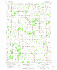
1968 Map of Allenton
USGS Topo · Published 1970About this map
The Belle River winds through this rural landscape of northern St. Clair County, anchoring a region defined by agricultural plots and small crossroads settlements during the late 1960s. The village of Allenton sits near the center of the sheet, while Berville and Lesterville mark other key points of local commerce and community. The map reveals an interesting industrial overlay with the Berlin Oil Field spanning several sections in the southern half of Berlin Township, illustrating the era's energy exploration alongside traditional farming.
Find a feature on this map
61 named features on this map. Tap any name to fly to it.
Don’t see what you’re looking for? This feature index may not catch every label — zoom into the map to look around manually.
Map Details
Editions of this 1968 Allenton Map
This is the sole edition of this map. No revisions or reprints were ever made.
Other maps of this area

1914 · Armada
USGS Topo · 1:62,500

1928 · Armada
USGS Topo · 1:62,500

1943 · Romeo
USGS Topo · 1:24,000

1944 · Memphis
USGS Topo · 1:24,000

1945 · Armada
USGS Topo · 1:24,000

1945 · Almont
USGS Topo · 1:24,000

1945 · Allenton
USGS Topo · 1:24,000

1945 · Richmond
USGS Topo · 1:24,000

1945 · Romeo
USGS Topo · 1:24,000

1952 · Allenton
USGS Topo · 1:24,000