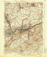
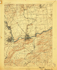
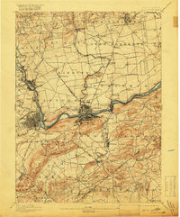
1894 Map of Allentown
USGS Topo · Published 1894This historical map portrays the area of Allentown in 1894, primarily covering Lehigh County as well as portions of Bucks County and Northampton County. Featuring a scale of 1:62500, this map provides a highly detailed snapshot of the terrain, roads, buildings, counties, and historical landmarks in the Allentown region at the time. Published in 1894, it is one of 10 known editions of this map due to revisions or reprints.
Map Details
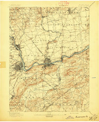
Editions of this 1894 Allentown Map
10 editions found
1894 edition
16.5 x 19.9 inches
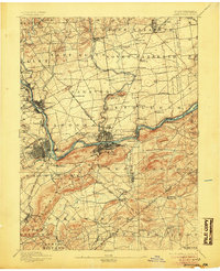
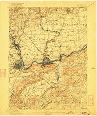
1897 edition
16.5 x 20.4 inches
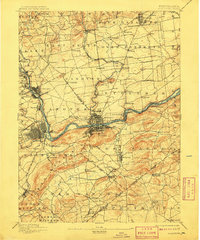
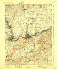
1898 edition
15.8 x 19.6 inches
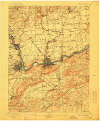
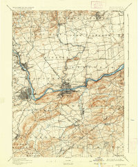
1905 edition
16.5 x 20.3 inches
1909 edition
16.5 x 19.9 inches
1912 edition
16.5 x 19.9 inches
1918 edition
16.5 x 19.9 inches
1922 edition
16.5 x 19.9 inches
1928 edition
16.5 x 19.9 inches
1936 edition
16.5 x 19.9 inches
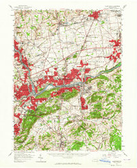
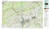
Historical Maps of Fountain Hill Through Time
4 maps found