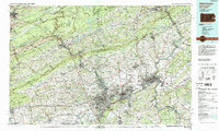
1984 Map of Allentown
USGS Topo · Published 1988About this map
Industrial and educational hubs define the landscape where the Lehigh River meets the Delaware River during the mid-1980s. The urban corridor of Allentown, Bethlehem, and Easton dominates the southern reaches, serving as a center for higher learning with institutions like Lehigh University, Lafayette College, and Moravian College established amidst the river valleys. To the north, the terrain transitions into the ridgelines of Blue Mountain and Kittatinny Mountain, where the dramatic Delaware Water Gap marks the state line. This era captures the region's complex infrastructure, where historical transportation routes like the Lehigh Valley RR and Reading RR intersect with modern arteries like Interstate 78. Notable cultural landmarks, including the Old Pioneer Cem and Jim Thorpe, reflect a deep layering of regional history from early coal transport to modern recreation within State Game Lands No 141.
Find a feature on this map
225 named features on this map. Tap any name to fly to it.
Don’t see what you’re looking for? This feature index may not catch every label — zoom into the map to look around manually.
Map Details
Editions of this 1984 Allentown Map
3 editions found
Other maps of this area

1888 · Hackettstown
USGS Topo · 1:62,500

1888 · Quakertown
USGS Topo · 1:62,500

1889 · Hazleton
USGS Topo · 1:62,500

1889 · Pottsville
USGS Topo · 1:62,500

1890 · Easton
USGS Topo · 1:62,500

1890 · High Bridge
USGS Topo · 1:62,500

1890 · Lambertville
USGS Topo · 1:62,500

1890 · Doylestown
USGS Topo · 1:62,500

1890 · Quakertown
USGS Topo · 1:62,500

1891 · Easton
USGS Topo · 1:62,500