1978 Map of Allentown
USGS Topo · Published 1987About this map
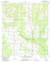
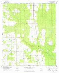
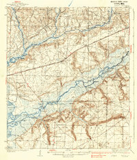
Allentown serves as the focal point of this Santa Rosa County landscape, characterized by a mix of agricultural clearings and dense woodland drainage systems. The community is anchored by the Allentown Sch and a Radio Tower, while the U S Naval Res site indicates a federal military presence in the area. The map reveals an active extractive industry with numerous Oil Well sites and Claypit locations scattered across the terrain, particularly near Harmony.
Find a feature on this map
34 named features on this map. Tap any name to fly to it.
Don’t see what you’re looking for? This feature index may not catch every label — zoom into the map to look around manually.
Map Details
Editions of this 1978 Allentown Map
2 editions found
Other maps of this area

1920 · Milton
USGS Topo · 1:62,500
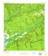
1934 · Harold
USGS Topo · 1:62,500
1937 · Harold
USGS Topo · 1:62,500
1938 · Harold
USGS Topo · 1:62,500

1941 · Milton
USGS Topo · 1:62,500

1943 · Milton
USGS Topo · 1:62,500

1943 · Jay
USGS Topo · 1:62,500
1948 · Munson
USGS Topo · 1:62,500
1950 · Munson
USGS Topo · 1:62,500

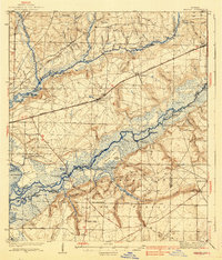
1957 · Pensacola
USGS Topo · 1:250,000