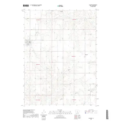
2018 Map of Allerton
USGS Topo · Published 2018About this map
Corydon and Allerton anchor this survey of southern Wayne County, Iowa, where the headwaters of the Medicine Creek system begin to carve the rolling prairie. The landscape is defined by its agricultural grid, intersected by significant drainage ways like W Jackson Cr and E Fork Medicine Cr. Genealogists will find an exceptional density of rural burial grounds, including Rankin Cem, Richardson Cem, and Shriver Cem, which often serve as the remaining physical evidence of early settlement clusters near former railroad junctions. The small communities of Harvard and Sewal sit along established east-west corridors, while Allerton displays its traditional street plan featuring names like W Maple St and W Spruce St. This map documents a quiet, enduring rural geography where land ownership lines are still heavily influenced by the Public Land Survey System township and range boundaries.
Find a feature on this map
39 named features on this map. Tap any name to fly to it.
Don’t see what you’re looking for? This feature index may not catch every label — zoom into the map to look around manually.
Map Details
Editions of this 2018 Allerton Map
This is the sole edition of this map. No revisions or reprints were ever made.
Other maps of this area

1934 · Humeston
USGS Topo · 1:48,000

1935 · Russell
USGS Topo · 1:62,500

1937 · Corydon
USGS Topo · 1:62,500

1938 · Russell
USGS Topo · 1:62,500

1942 · Seymour
USGS Topo · 1:62,500

1944 · Seymour
USGS Topo · 1:62,500

1954 · Centerville
USGS Topo · 1:250,000

1957 · Centerville
USGS Topo · 1:250,000

1958 · Centerville
USGS Topo · 1:250,000

1964 · Allerton
USGS Topo · 1:24,000