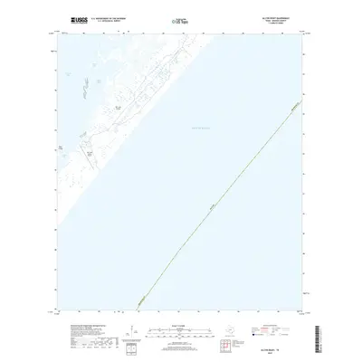
2019 Map of Allyns Bight
USGS Topo · Published 2019About this map
San Jose Island dominates this coastal landscape along the Texas shoreline, separating the protected waters of Aransas Bay from the open Gulf of Mexico. The barrier island geography is defined by a series of saltwater features, including the eponymous Allyns Bight and the nearby Allyns Lake. In the southern portion of the island, the San Jose Island Airport provides a remote point of access to this narrow strip of land. To the west, Mud Island sits within the bay, while Blind Pass marks a critical break in the coastal barrier system. This 2019 survey documents the shifting marshlands and intricate inlets, such as Long Lake, that characterize the Aransas County coast during the early 21st century.
Find a feature on this map
11 named features on this map. Tap any name to fly to it.
Don’t see what you’re looking for? This feature index may not catch every label — zoom into the map to look around manually.
Map Details
Editions of this 2019 Allyns Bight Map
This is the sole edition of this map. No revisions or reprints were ever made.
Other maps of this area

1925 · Aransas Pass
USGS Topo · 1:62,500

1950 · Corpus Christi
USGS Topo · 1:250,000

1951 · Allyns Bight
USGS Topo · 1:24,000

1952 · St. Charles Bay SW
USGS Topo · 1:24,000

1952 · St. Charles Bay SE
USGS Topo · 1:24,000

1953 · Beeville
USGS Topo · 1:250,000

1954 · Rockport
USGS Topo · 1:62,500

1954 · Estes
USGS Topo · 1:24,000
1954 · Port Aransas
USGS Topo · 1:24,000

1954 · Aransas Pass
USGS Topo · 1:62,500