
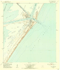
1951 Map of Allyns Bight
USGS Topo · Published 1953About this map
St Joseph Island dominates this coastal survey, appearing as a dynamic barrier landform shaped by shifting sands and the relentless energy of the Gulf of Mexico. Along the bay side, the topography is defined by intricate Sand and Mud Flats and narrow waterways, including Blind Pass and the secluded Allyn Lake. A small Landing Strip on the island provides a lone indicator of human infrastructure amidst the shifting sand dunes that reach heights of up to 25 feet. The boundary between the shallow waters of Aransas Bay and the deeper gulf is marked by the eponymous Allyns Bight, a pocket of water sheltered by the island’s inward curve. This 1951 field check captures the Texas coastline before modern development, documenting the natural state of Mud Island and the complex tidal margins of the Aransas County shore.
Find a feature on this map
12 named features on this map. Tap any name to fly to it.
Don’t see what you’re looking for? This feature index may not catch every label — zoom into the map to look around manually.
Map Details
Editions of this 1951 Allyns Bight Map
This is the sole edition of this map. No revisions or reprints were ever made.
Other maps of this area

1925 · Aransas Pass
USGS Topo · 1:62,500

1950 · Corpus Christi
USGS Topo · 1:250,000

1952 · St. Charles Bay SW
USGS Topo · 1:24,000

1952 · St. Charles Bay SE
USGS Topo · 1:24,000

1953 · Beeville
USGS Topo · 1:250,000

1954 · Rockport
USGS Topo · 1:62,500

1954 · Estes
USGS Topo · 1:24,000
1954 · Port Aransas
USGS Topo · 1:24,000

1954 · Aransas Pass
USGS Topo · 1:62,500

1956 · Corpus Christi
USGS Topo · 1:250,000