
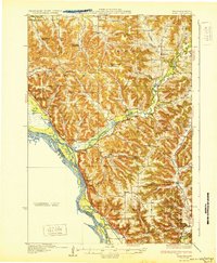
1932 Map of Alma
USGS Topo · Published 1932About this map
The Mississippi River and the winding Buffalo River dominate this 1932 survey, illustrating the complex hydrology of the Driftless Area before modern land-use changes. The landscape is defined by its deep coulees and ridges, including Alma Ridge and Huber Ridge, which hem in a network of small rural school districts like Tell Sch and Lakeview Sch. These isolated educational centers, often named for nearby creeks or landowners, reflect the highly localized social structure of the early 20th-century Wisconsin bluff country.
Find a feature on this map
49 named features on this map. Tap any name to fly to it.
Don’t see what you’re looking for? This feature index may not catch every label — zoom into the map to look around manually.
Map Details
Editions of this 1932 Alma Map
2 editions found
Other maps of this area

1929 · Fountain City
USGS Topo · 1:62,500

1929 · Durand
USGS Topo · 1:62,500

1932 · Cochrane
USGS Topo · 1:62,500

1932 · Gilmanton
USGS Topo · 1:62,500

1932 · Wabasha
USGS Topo · 1:62,500

1932 · Durand
USGS Topo · 1:62,500

1932 · Mondovi
USGS Topo · 1:62,500

1934 · Winona
USGS Topo · 1:62,500

1934 · Plainview
USGS Topo · 1:62,500

1934 · Cochrane
USGS Topo · 1:62,500