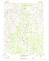
1970 Map of Alma
USGS Topo · Published 1973About this map
Alma sits at the heart of this high-altitude mining landscape, where the Middle Fork South Platte River descends from the Continental Divide. The 1970s survey captures a territory defined by historic extraction, featuring numerous heritage sites like the Quartzville and Dudley town sites. An intensive network of mining operations is evident along the gulches, including the Sweet Home Mine, Buckskin Joe Mine, and Paris Mill.
Find a feature on this map
76 named features on this map. Tap any name to fly to it.
Don’t see what you’re looking for? This feature index may not catch every label — zoom into the map to look around manually.
Map Details
Editions of this 1970 Alma Map
4 editions found
Other maps of this area

1889 · Leadville
USGS Topo · 1:125,000

1891 · Leadville
USGS Topo · 1:125,000

1934 · Climax
USGS Topo · 1:48,000

1937 · Como
USGS Topo · 1:62,500

1938 · Mt. Lincoln
USGS Topo · 1:48,000

1942 · Leadville
USGS Topo · 1:125,000

1945 · Mount Lincoln
USGS Topo · 1:62,500

1953 · Denver
USGS Topo · 1:250,000

1956 · Fairplay East
USGS Topo · 1:24,000

1957 · Denver
USGS Topo · 1:250,000