2022 Map of Alma
USGS Topo · Published 2022About this map
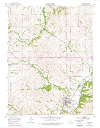
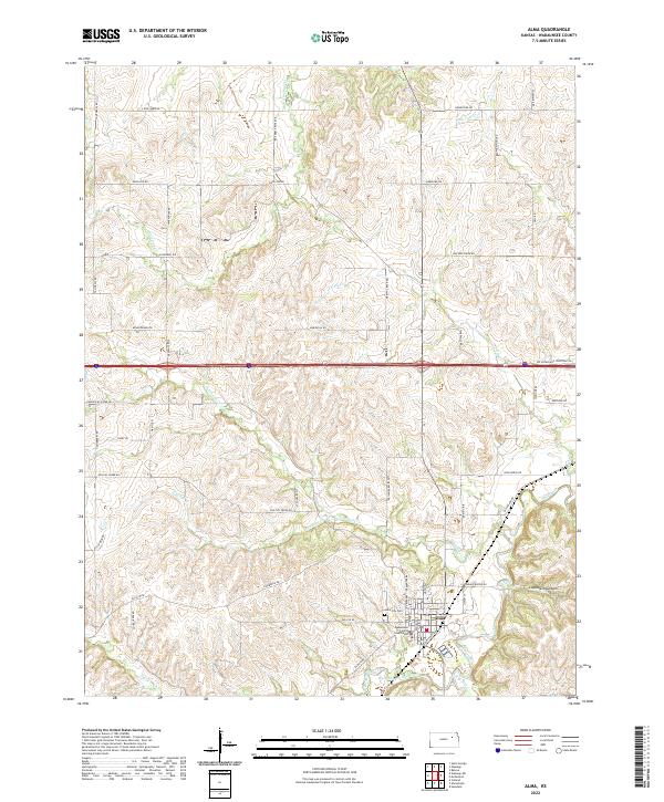
Alma serves as the focal point of this Wabaunsee County landscape, where the Wabaunsee County Courthouse and the Alma City Cem mark the heart of the community. The surrounding terrain is defined by a dense network of drainage systems, most notably Mill Creek and its various tributaries including West Branch Mill Creek and S Br Mill Cr. The map reveals a land structured by both its topography and its history, with named landmarks like Clapboard Canyon and Phillips Cr weaving between an extensive grid of country roads. Local infrastructure is anchored by routes such as Old K18 Rd and Fairfield Rd, while the path of Loire Cr and Antelope Cr highlights the natural corridors that have shaped local settlement and agriculture for generations.
Find a feature on this map
60 named features on this map. Tap any name to fly to it.
Don’t see what you’re looking for? This feature index may not catch every label — zoom into the map to look around manually.
Map Details
Editions of this 2022 Alma Map
This is the sole edition of this map. No revisions or reprints were ever made.