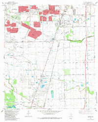
1982 Map of Almeda
USGS Topo · Published 1983About this map
Urban expansion from Houston moves southward into the prairie along the corridor formed by the Missouri Pacific and the Atchison Topeka and Santa Fe railroads. The landscape is a study in transition, where new residential developments like Windsor Village and the Southgate Shopping Center stand in contrast to established rural centers and specialized institutions. The Blue Ridge State Prison Farm occupies the northwest corner, while the Blue Ridge oil field is marked by numerous wells and the Hobby settlement.
Find a feature on this map
70 named features on this map. Tap any name to fly to it.
Don’t see what you’re looking for? This feature index may not catch every label — zoom into the map to look around manually.
Map Details
Editions of this 1982 Almeda Map
This is the sole edition of this map. No revisions or reprints were ever made.
Other maps of this area

1915 · Bellaire
USGS Topo · 1:24,000

1915 · Park Place
USGS Topo · 1:24,000

1915 · Alief
USGS Topo · 1:24,000

1920 · Mykawa
USGS Topo · 1:31,680

1920 · Almeda
USGS Topo · 1:31,680

1921 · Bellaire
USGS Topo · 1:31,680

1922 · Park Place
USGS Topo · 1:31,680

1943 · Juliff
USGS Topo · 1:31,680

1950 · Houston
USGS Topo · 1:250,000

1953 · Thompsons
USGS Topo · 1:24,000