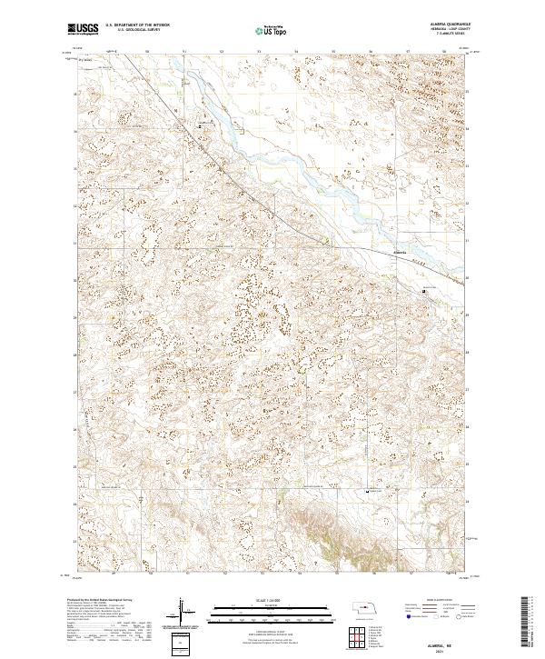
2021 Map of Almeria
USGS Topo · Published 2021About this map
The North Loup River winds through the heart of this Loup County landscape, where the settlement of Almeria serves as a central point of reference. This 2021 survey by the U.S. Geological Survey illustrates a sparsely populated agricultural region defined by its sections and sandhill-transition terrain. For genealogists and local historians, several burial sites are clearly marked, including Almeria Cem near the town site, Moulton Cem to the northwest, and Madison Square Cem in the southern portion of the quadrangle. The road network reflects the rural character of the area, with routes like Dry Valley Rd, Knobby Ridge Rd, and Madison Square Rd following the section lines and natural contours of the valley floor. The map provides a current perspective on the enduring spatial organization of this part of Nebraska, maintaining the same township and range divisions established during early settlement.
Find a feature on this map
17 named features on this map. Tap any name to fly to it.
Don’t see what you’re looking for? This feature index may not catch every label — zoom into the map to look around manually.
Map Details
Editions of this 2021 Almeria Map
This is the sole edition of this map. No revisions or reprints were ever made.
Other maps of this area

1951 · Walworth
USGS Topo · 1:24,000

1951 · Milburn
USGS Topo · 1:24,000

1952 · Taylor NW
USGS Topo · 1:24,000

1952 · Almeria NE
USGS Topo · 1:24,000

1952 · Sargent West
USGS Topo · 1:24,000

1952 · Almeria NW
USGS Topo · 1:24,000

1952 · Almeria SW
USGS Topo · 1:24,000

1952 · Almeria
USGS Topo · 1:24,000

1952 · Taylor
USGS Topo · 1:24,000

1955 · Broken Bow
USGS Topo · 1:250,000