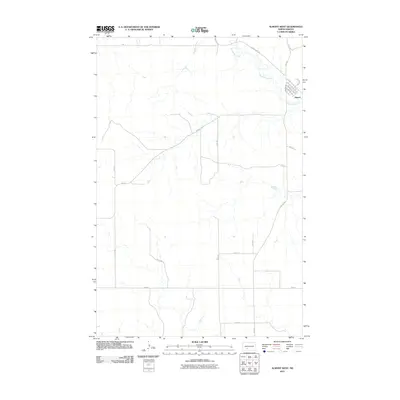
2011 Map of Almont West
USGS Topo · Published 2011About this map
Almont anchors the northeastern corner of this Morton County landscape, where the local street grid is defined by thoroughfares like Mandan Ave, Dakota Ave, and Morton Ave. The settlement is situated at a bend in Big Muddy Creek, which snakes across the northern sections of the quadrangle before flowing south and east. This 2011 survey reflects the rural character of central North Dakota, showing a highly organized section-line road system. Major corridors such as County Hwy 138 and County Rd 137 provide the primary connections through the undulating terrain. The drainage patterns of the creek and its numerous unnamed tributaries illustrate the natural geography that dictates the placement of outlying roads like 53rd St and 55th Ave in this sparsely populated agricultural region.
Find a feature on this map
24 named features on this map. Tap any name to fly to it.
Don’t see what you’re looking for? This feature index may not catch every label — zoom into the map to look around manually.
Map Details
Editions of this 2011 Almont West Map
This is the sole edition of this map. No revisions or reprints were ever made.
Other maps of this area

1954 · Bismarck
USGS Topo · 1:250,000

1958 · Bismarck
USGS Topo · 1:250,000

1960 · North Almont
USGS Topo · 1:24,000

1960 · Dengate
USGS Topo · 1:24,000

1960 · New Salem
USGS Topo · 1:24,000

1980 · Otter Creek West
USGS Topo · 1:24,000

1980 · Crown Butte Creek NW
USGS Topo · 1:24,000

1980 · Crown Butte Creek SE
USGS Topo · 1:24,000

1980 · Almont East
USGS Topo · 1:24,000

1980 · Crown Butte Creek SW
USGS Topo · 1:24,000