
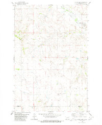
1980 Map of Almont East
USGS Topo · Published 1980About this map
Almont serves as the primary settlement on this North Dakota prairie landscape, situated near the head of Curlew Valley. The map documents a rural environment shaped by the drainage patterns of Big Muddy Creek and White Butte Creek, with several prominent landmarks such as Sugarloaf and White Butte rising above the surrounding terrain. Of particular interest to local historians is the Old Railroad Grade, which traces a former transportation corridor through the hills. The community infrastructure is represented by the Almont Cem and the Rodeo Ground, reflecting the social and cultural focal points of the area. In the southern portion, the Morton Co Grant Co line divides the ranching country near Antelope Butte. The presence of several springs and a Gaging Sta on the creek indicates the vital importance of water management in this semi-arid region.
Find a feature on this map
18 named features on this map. Tap any name to fly to it.
Don’t see what you’re looking for? This feature index may not catch every label — zoom into the map to look around manually.
Map Details
Editions of this 1980 Almont East Map
This is the sole edition of this map. No revisions or reprints were ever made.
Other maps of this area

1954 · Bismarck
USGS Topo · 1:250,000

1958 · Bismarck
USGS Topo · 1:250,000

1960 · North Almont
USGS Topo · 1:24,000

1960 · New Salem
USGS Topo · 1:24,000

1970 · Judson
USGS Topo · 1:24,000

1980 · Otter Creek West
USGS Topo · 1:24,000

1980 · Green Ridge
USGS Topo · 1:24,000

1980 · Otter Creek East
USGS Topo · 1:24,000

1980 · Crown Butte Creek SE
USGS Topo · 1:24,000
1980 · Almont West
USGS Topo · 1:24,000