
1970 Map of Judson
USGS Topo · Published 1972About this map
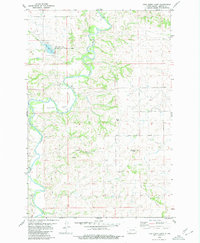
Judson sits at the heart of this Morton County landscape, a small community positioned along the Burlington Northern railroad corridor. The area's mid-century topography is defined by the contrast between its drainage systems, such as Sweet Briar Creek and Fish Creek, and the emerging recreational and industrial sites of the era. The presence of several Lignite Pits and a Gravel Pit reflects the region's reliance on earth resources, while the Sweet Briar Dam State Game Management Area surrounding Sweet Briar Lake points to a transition toward conservation and public use. This 1970 field-checked survey provides a look at the rural infrastructure of the time, from the placement of a Gaging Station to the bypass of Interstate 94 and Highway 10 north of the town center.
Find a feature on this map
14 named features on this map. Tap any name to fly to it.
Don’t see what you’re looking for? This feature index may not catch every label — zoom into the map to look around manually.
Map Details
Editions of this 1970 Judson Map
This is the sole edition of this map. No revisions or reprints were ever made.
Other maps of this area

1954 · Bismarck
USGS Topo · 1:250,000

1958 · Bismarck
USGS Topo · 1:250,000

1960 · New Salem
USGS Topo · 1:24,000

1970 · New Salem NW
USGS Topo · 1:24,000

1970 · New Salem NE
USGS Topo · 1:24,000

1972 · Sweet Briar
USGS Topo · 1:24,000

1972 · Crown Butte NW
USGS Topo · 1:24,000

1980 · Green Ridge
USGS Topo · 1:24,000

1980 · Almont East
USGS Topo · 1:24,000
1980 · Fish Creek Lake
USGS Topo · 1:24,000