
1972 Map of Sweet Briar
USGS Topo · Published 1974About this map
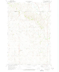
Heart River valley and its surrounding Morton County prairie appear as they were in the early 1970s, characterized by the winding waterway and the prominent Sweet Briar Creek. The landscape shows the transition from natural drainage patterns to managed land use, with the Sweet Briar Dam State Game Management Area anchoring the northern section. This territory was a corridor of movement and resource extraction, defined by the Burlington Northern railroad trackage that follows the creek's path and several Gravel Pits scattered near the rail line. Small infrastructure details, such as a long-distance Pipeline and a Flowing Well near the river, reflect the regional focus on water management and energy transport. The map provides a clear picture of the township boundaries between T. 139 N. and T. 138 N., offering specific locations for family-named landmarks and local sites like Sweet Briar.
Find a feature on this map
12 named features on this map. Tap any name to fly to it.
Don’t see what you’re looking for? This feature index may not catch every label — zoom into the map to look around manually.
Map Details
Editions of this 1972 Sweet Briar Map
This is the sole edition of this map. No revisions or reprints were ever made.
Other maps of this area

1954 · Bismarck
USGS Topo · 1:250,000

1958 · Bismarck
USGS Topo · 1:250,000

1970 · Judson
USGS Topo · 1:24,000

1970 · New Salem NE
USGS Topo · 1:24,000

1972 · Crown Butte Lake
USGS Topo · 1:24,000

1972 · Crown Butte NW
USGS Topo · 1:24,000
1972 · Crown Butte
USGS Topo · 1:24,000

1980 · Green Ridge
USGS Topo · 1:24,000

1980 · Fallon NE
USGS Topo · 1:24,000
1980 · Fish Creek Lake
USGS Topo · 1:24,000