
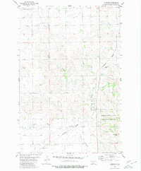
1980 Map of Fallon NE
USGS Topo · Published 1980About this map
Little Heart River meanders across this rural Morton County landscape, shaping a series of wide, low-lying terraces known locally as Little Heart Flats and Custer Flats. The 1980 survey captures a late-twentieth-century agrarian pattern where local gathering points are anchored by small churches and markers of early settlement. Notable spiritual and social centers include Stone Ch, located near a small Cem, and Rural Ch further to the northeast. The map provides clear evidence of the area's water sources, vital for prairie life, through numerous labeled points for Well and a seasonal Spring. This documentation of sectional lines and rural landmarks preserves the specific mid-century layout of the Dakota plains before further modernization changed the township's footprint.
Find a feature on this map
12 named features on this map. Tap any name to fly to it.
Don’t see what you’re looking for? This feature index may not catch every label — zoom into the map to look around manually.
Map Details
Editions of this 1980 Fallon NE Map
This is the sole edition of this map. No revisions or reprints were ever made.
Other maps of this area

1907 · Bismarck
USGS Topo · 1:125,000

1951 · Bismarck
USGS Topo · 1:62,500

1951 · Mandan
USGS Topo · 1:24,000

1954 · Bismarck
USGS Topo · 1:250,000

1958 · Bismarck
USGS Topo · 1:250,000

1962 · Mandan
USGS Topo · 1:24,000

1972 · Sweet Briar
USGS Topo · 1:24,000

1972 · Crown Butte Lake
USGS Topo · 1:24,000

1979 · Bismarck
USGS Topo · 1:100,000
1980 · Lynwood
USGS Topo · 1:24,000