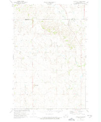
1972 Map of Crown Butte
USGS Topo · Published 1974About this map
Crown Butte dominates the southwestern portion of this 1970s landscape, serving as a prominent landmark in a region defined by the divide between the Oliver Co and Morton Co line. The area exhibits a mix of natural drainages and emerging industrial activity, evidenced by the presence of a Strip Mine and a major Pipeline cutting across the terrain. Waterways such as Square Butte Creek and Otter Creek carve through the plains, illustrating the drainage patterns that shaped local land use. This survey captures a moment when traditional agricultural fencing, marked by fine red dashed lines, coexisted with modern infrastructure, providing a clear view of the rural spatial organization before later developments.
Find a feature on this map
6 named features on this map. Tap any name to fly to it.
Don’t see what you’re looking for? This feature index may not catch every label — zoom into the map to look around manually.
Map Details
Editions of this 1972 Crown Butte Map
This is the sole edition of this map. No revisions or reprints were ever made.
Other maps of this area

1907 · Bismarck
USGS Topo · 1:125,000

1950 · Wilton
USGS Topo · 1:62,500

1951 · Bismarck
USGS Topo · 1:62,500

1951 · Mandan
USGS Topo · 1:24,000

1954 · Bismarck
USGS Topo · 1:250,000

1954 · McClusky
USGS Topo · 1:250,000

1958 · Bismarck
USGS Topo · 1:250,000

1958 · McClusky
USGS Topo · 1:250,000

1962 · Harmon
USGS Topo · 1:24,000

1962 · Mandan
USGS Topo · 1:24,000