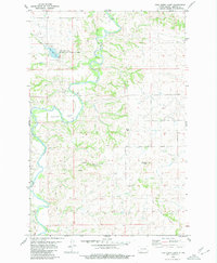
1980 Map of Fish Creek Lake
USGS Topo · Published 1980About this map
The Heart River carves a winding path through this portion of Morton County, defining a landscape of deep coulees and prominent high points. In the northern reaches, the Fish Creek Lake State Wildlife Management Area surrounds the waters of Fish Creek Lake, which was created at the confluence of Fish Creek and the river. This 1980 survey captures the rural character of the region, where transportation is marked by the Stark Bridge and a network of primitive Jeep Trails that negotiate the broken terrain. To the south, the topography rises toward Chimney Butte and the defined Oak Coulee Ridge, while the riverbed reveals the broad Goose Bar. This map illustrates the intersection of water resources and conservation land in a part of North Dakota characterized by significant vertical relief, from the low drainage of Oak Coulee to the isolated peaks overlooking the valley.
Find a feature on this map
18 named features on this map. Tap any name to fly to it.
Don’t see what you’re looking for? This feature index may not catch every label — zoom into the map to look around manually.
Map Details
Editions of this 1980 Fish Creek Lake Map
This is the sole edition of this map. No revisions or reprints were ever made.
Other maps of this area

1954 · Bismarck
USGS Topo · 1:250,000

1958 · Bismarck
USGS Topo · 1:250,000

1970 · Judson
USGS Topo · 1:24,000

1972 · Sweet Briar
USGS Topo · 1:24,000

1972 · Crown Butte Lake
USGS Topo · 1:24,000

1980 · Green Ridge
USGS Topo · 1:24,000

1980 · Otter Creek East
USGS Topo · 1:24,000

1980 · Fallon NE
USGS Topo · 1:24,000

1980 · Nygren Dam
USGS Topo · 1:24,000
1980 · Fallon
USGS Topo · 1:24,000