
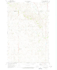
1972 Map of Crown Butte NW
USGS Topo · Published 1974About this map
The county line between Oliver Co and Morton Co divides this landscape, reflecting the agricultural and industrial character of the region in the early 1970s. The survey illustrates the intersection of rural community life and resource extraction, with a Lignite Pit in the north and various Gravel Pits scattered to the south. These features, along with an extensive Pipeline, highlight the era's reliance on the local geology for energy and infrastructure material. Religious and memorial sites serve as the primary landmarks for the local population, including St Vincent Ch near the southern edge and Rosebud Cem to the northwest. The terrain is detailed with fine red dashed lines that indicate the specific fence and field lines visible from the air at the time of the survey, offering a precise look at mid-century land division and farming boundaries.
Find a feature on this map
7 named features on this map. Tap any name to fly to it.
Don’t see what you’re looking for? This feature index may not catch every label — zoom into the map to look around manually.
Map Details
Editions of this 1972 Crown Butte NW Map
This is the sole edition of this map. No revisions or reprints were ever made.
Other maps of this area

1954 · Bismarck
USGS Topo · 1:250,000

1954 · McClusky
USGS Topo · 1:250,000

1958 · Bismarck
USGS Topo · 1:250,000

1958 · McClusky
USGS Topo · 1:250,000

1970 · Judson
USGS Topo · 1:24,000

1970 · New Salem NE
USGS Topo · 1:24,000

1972 · Sweet Briar
USGS Topo · 1:24,000

1972 · Center
USGS Topo · 1:24,000

1972 · Crown Butte Lake
USGS Topo · 1:24,000
1972 · Crown Butte
USGS Topo · 1:24,000