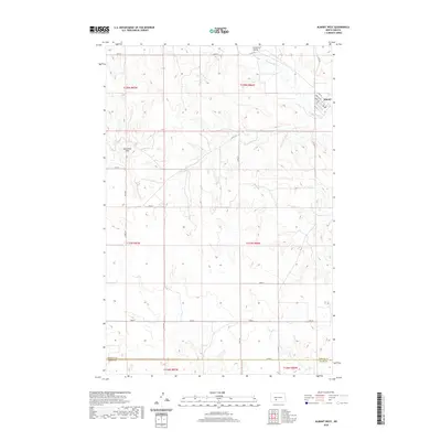
2020 Map of Almont West
USGS Topo · Published 2020About this map
Big Muddy Cr snakes through the northeast corner of this terrain, anchoring the small community of Almont. Situated near the junction of Co Rd 86 and Co Rd 137, the settlement is defined by a grid of streets including Dakota Ave and Burt Ave. To the west, the topography rises into the Ramsland Hills, while the broad Curlew Valley opens to the north. This survey illustrates the high plains landscape of the Morton County and Grant County border, where a network of section roads like 52nd St and 54th Ave crisscrosses the open range, following the established Public Land Survey System divisions.
Find a feature on this map
25 named features on this map. Tap any name to fly to it.
Don’t see what you’re looking for? This feature index may not catch every label — zoom into the map to look around manually.
Map Details
Editions of this 2020 Almont West Map
This is the sole edition of this map. No revisions or reprints were ever made.
Other maps of this area

1954 · Bismarck
USGS Topo · 1:250,000

1958 · Bismarck
USGS Topo · 1:250,000

1960 · North Almont
USGS Topo · 1:24,000

1960 · Dengate
USGS Topo · 1:24,000

1960 · New Salem
USGS Topo · 1:24,000

1980 · Otter Creek West
USGS Topo · 1:24,000

1980 · Crown Butte Creek NW
USGS Topo · 1:24,000

1980 · Crown Butte Creek SE
USGS Topo · 1:24,000

1980 · Almont East
USGS Topo · 1:24,000

1980 · Crown Butte Creek SW
USGS Topo · 1:24,000