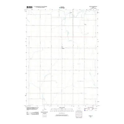
2010 Map of Alpha
USGS Topo · Published 2010About this map
Alpha and Richfield anchor this rural landscape in Fayette County, showing the orderly agricultural grid of northeastern Iowa during the first decade of the 2000s. The area is defined by its diverse drainage patterns, where the headwaters of the Volga River and the Little Wapsipinicon River diverge, winding through a network of sections bounded by gravel roads like Vanderbilt Ave and York Ave. This intersection of water systems provided the natural basis for early settlement, though by this era, the land is dominated by large-scale farming plots. Genealogists will find the locations of Bethel Cemetery and Richfield Cemetery clearly plotted, serving as key landmarks for family history research in this corner of the state. The map also traces smaller tributaries such as Marsh Creek and Haugh Creek, which further illustrate the subtle topographic variations that have shaped local land use for generations.
Find a feature on this map
38 named features on this map. Tap any name to fly to it.
Don’t see what you’re looking for? This feature index may not catch every label — zoom into the map to look around manually.
Map Details
Editions of this 2010 Alpha Map
This is the sole edition of this map. No revisions or reprints were ever made.
Other maps of this area

1901 · Oelwein
USGS Topo · 1:125,000

1906 · Decorah
USGS Topo · 1:125,000

1954 · Mason City
USGS Topo · 1:250,000

1954 · Waterloo
USGS Topo · 1:250,000

1955 · Waterloo
USGS Topo · 1:250,000

1957 · Mason City
USGS Topo · 1:250,000

1958 · Mason City
USGS Topo · 1:250,000

1958 · La Crosse
USGS Topo · 1:250,000

1959 · Dubuque
USGS Topo · 1:250,000

1961 · Dubuque
USGS Topo · 1:250,000