
1958 Map of Alpine
USGS Topo · Published 1960About this map
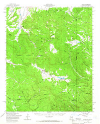
Alpine sits at the heart of this high-elevation landscape, where the headwaters of the San Francisco River and Blue River begin their descent. This 1950s survey documents the community at a time when the logging and ranching economy was physically marked by features like the Alpine Timber Camp and the White Mountain Boys Ranch. To the north, the massive profile of Escudilla Mountain dominates the horizon, while the Coronado Trail and U. S. 666 provide the primary transit through the Apache National Forest. The map captures the complex drainage patterns of the region, from the Luna Lake basin to the numerous named springs like Whitetail Spring and Miller Scott Spring that supported local livestock and early settlements like Nutrioso. For researchers, the inclusion of remote campsites and specific forest trails like the Nutrioso Trail offers a detailed view of mid-century land use and recreation in the Arizona-New Mexico borderlands.
Find a feature on this map
99 named features on this map. Tap any name to fly to it.
Don’t see what you’re looking for? This feature index may not catch every label — zoom into the map to look around manually.
Map Details
Editions of this 1958 Alpine Map
3 editions found
Other maps of this area

1886 · St Johns
USGS Topo · 1:250,000

1892 · St Johns
USGS Topo · 1:250,000

1915 · Reserve
USGS Topo · 1:125,000

1918 · Reserve
USGS Topo · 1:125,000

1922 · Nutrioso
USGS Topo · 1:125,000

1954 · Clifton
USGS Topo · 1:250,000

1954 · Saint Johns
USGS Topo · 1:250,000

1957 · Clifton
USGS Topo · 1:250,000

1957 · Saint Johns
USGS Topo · 1:250,000

1958 · Clifton
USGS Topo · 1:250,000