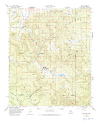
1958 Map of Alpine
USGS Topo · Published 1975About this map
Alpine and Nutrioso serve as the primary anchors for this high-altitude landscape in the mid-1950s, situated within the Apache National Forest. The map documents a period of active land use and community development, highlighted by the White Mountain Boys Ranch and the Alpine Timber Camp. Water management is evident through features like Riggs Creek Reservoir and Luna Lake, while the local economy is punctuated by a Sawmill and various ranger stations. The terrain is defined by prominent peaks such as Escudilla Mountain and Gobbler Peak, with the San Francisco River cutting through the valley. This survey reflects the intersection of federal forestry management and small-town Arizona life, capturing the layout of remote outposts and family-named landmarks like Campbell Flat and Miller Scott Spring before later modernization altered the forest's footprint.
Find a feature on this map
72 named features on this map. Tap any name to fly to it.
Don’t see what you’re looking for? This feature index may not catch every label — zoom into the map to look around manually.
Map Details
Editions of this 1958 Alpine Map
3 editions found

Other maps of this area

1886 · St Johns
USGS Topo · 1:250,000

1892 · St Johns
USGS Topo · 1:250,000

1915 · Reserve
USGS Topo · 1:125,000

1918 · Reserve
USGS Topo · 1:125,000

1922 · Nutrioso
USGS Topo · 1:125,000

1954 · Clifton
USGS Topo · 1:250,000

1954 · Saint Johns
USGS Topo · 1:250,000

1957 · Clifton
USGS Topo · 1:250,000

1957 · Saint Johns
USGS Topo · 1:250,000

1958 · Clifton
USGS Topo · 1:250,000