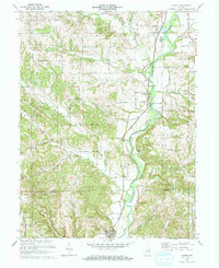
1971 Map of Alpine
USGS Topo · Published 1973About this map
The Whitewater River valley dictates the geography of this eastern Indiana landscape, where the Penn Central railroad tracks parallel the water through the settlements of Nulltown, Alpine, and Laurel. The map reveals a transition from the river bottomlands to the dissected uplands of Columbia and Laurel townships, marked by numerous stream branches such as North Branch Garrison Creek and Pot Creek. Genealogists will find several rural burial sites, including Tullis Chapel Cem and Mt Zion Cem, which reflect the area's 19th-century pioneer roots. The presence of Delaware Camp, Boys Club Camp, and Bear Creek Camp highlights the area's mid-century role as a location for organized youth recreation and seasonal retreats, while a Gravel Pit near the river indicates the local extraction industry at the time of the 1971 revision.
Find a feature on this map
32 named features on this map. Tap any name to fly to it.
Don’t see what you’re looking for? This feature index may not catch every label — zoom into the map to look around manually.
Map Details
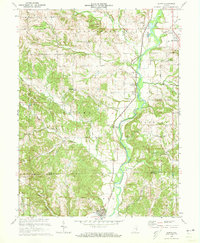
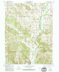
Editions of this 1971 Alpine Map
3 editions found
Other maps of this area

1953 · Cincinnati
USGS Topo · 1:250,000

1956 · Everton
USGS Topo · 1:24,000

1956 · Alpine
USGS Topo · 1:24,000

1956 · Brownsville
USGS Topo · 1:24,000

1956 · Metamora
USGS Topo · 1:24,000

1956 · Connersville
USGS Topo · 1:24,000

1956 · Brookville
USGS Topo · 1:24,000

1957 · Cincinnati
USGS Topo · 1:250,000

1958 · Clarksburg
USGS Topo · 1:24,000

1959 · New Salem
USGS Topo · 1:24,000