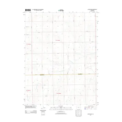
2013 Map of Alpine Ranch
USGS Topo · Published 2013About this map
Alpine Ranch occupies the high plains of Eastern Colorado, situated near the jurisdictional boundary of Kit Carson Co and Cheyenne Co. This high-desert landscape is defined by the winding course of the N Fork Smoky Hill River, which cuts diagonally across the terrain, joined in the south by the seasonal drainage of Cow Cr. The area is organized by an extensive grid of section-line roads, such as CO Road 30 and CO Road GG, reflecting the Public Land Survey System structure that continues to govern land use in this ranching region. The map captures the quiet intersection of modern infrastructure and traditional agricultural tracts at the start of the 2010s, showing the isolation and scale of individual ranch holdings like the Alpine Ranch complex.
Find a feature on this map
25 named features on this map. Tap any name to fly to it.
Don’t see what you’re looking for? This feature index may not catch every label — zoom into the map to look around manually.
Map Details
Editions of this 2013 Alpine Ranch Map
This is the sole edition of this map. No revisions or reprints were ever made.
Other maps of this area

1891 · Kit Carson
USGS Topo · 1:125,000

1892 · Cheyenne Wells
USGS Topo · 1:125,000

1893 · Kit Carson
USGS Topo · 1:125,000

1894 · Cheyenne Wells
USGS Topo · 1:125,000

1954 · Limon
USGS Topo · 1:250,000

1954 · Lamar
USGS Topo · 1:250,000

1957 · Limon
USGS Topo · 1:250,000

1958 · Limon
USGS Topo · 1:250,000

1958 · Lamar
USGS Topo · 1:250,000

1969 · Alpine Ranch NE
USGS Topo · 1:24,000