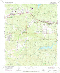
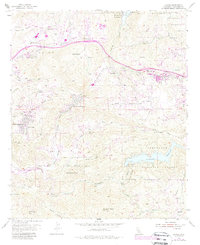
1955 Map of Alpine
USGS Topo · Published 1973About this map
The Sequan Indian Reservation and various family-named ranches anchor this mid-century topographic record of the San Diego backcountry. The terrain is characterized by steep canyons and valleys, with El Capitan Reservoir to the north and Loveland Reservoir to the south, the latter held by the Sweetwater Falls Dam. Human settlement is concentrated in pockets such as Alpine, where the Alpine Union High Sch serves as a local landmark, and the residential communities of Suncrest and La Cresta.
Find a feature on this map
57 named features on this map. Tap any name to fly to it.
Don’t see what you’re looking for? This feature index may not catch every label — zoom into the map to look around manually.
Map Details
Editions of this 1955 Alpine Map
5 editions found
Other maps of this area

1893 · El Cajon
USGS Topo · 1:62,500

1901 · Elcajon
USGS Topo · 1:62,500

1903 · Cuyamaca
USGS Topo · 1:125,000

1903 · Elcajon
USGS Topo · 1:62,500

1904 · Southern California Sheet No. 2
USGS Topo · 1:250,000

1939 · El Cajon
USGS Topo · 1:62,500

1942 · Potrero
USGS Topo · 1:48,000

1942 · El Cajon
USGS Topo · 1:62,500

1942 · Cuyamaca Peak
USGS Topo · 1:62,500

1943 · Jamul
USGS Topo · 1:62,500