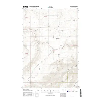
2017 Map of Alpowa Ridge
USGS Topo · Published 2017About this map
Alpowa Ridge dominates this corner of the Pacific Northwest, where the high plateaus of Garfield and Asotin Counties are deeply incised by a network of gulches and canyons. Small settlements like Smith Gulch and Pataha Valley are established along the valley floors, connected by a winding rural road network including Kirby Mayview Rd and Sweeney Gulch Rd. This 2017 survey illustrates the complex drainage systems typical of the region, where seasonal waters such as Pataha Cr and Alpowa Cr carve through the basaltic layers of the landscape. Strategic water sources, including Dresser Spring and Kaufman Springs, appear as critical landmarks for local land use. The map also traces prominent geological features like Valentine Ridge and Knotgrass Ridge, providing a clear view of the topographic boundaries and elevation changes that define this remote high-country terrain.
Find a feature on this map
45 named features on this map. Tap any name to fly to it.
Don’t see what you’re looking for? This feature index may not catch every label — zoom into the map to look around manually.
Map Details
Editions of this 2017 Alpowa Ridge Map
This is the sole edition of this map. No revisions or reprints were ever made.
Other maps of this area

1910 · Pullman
USGS Topo · 1:125,000

1937 · Pomeroy
USGS Topo · 1:96,000

1942 · Pomeroy
USGS Topo · 1:125,000

1943 · Peola
USGS Topo · 1:62,500

1946 · Peola
USGS Topo · 1:62,500

1950 · Penawawa
USGS Topo · 1:62,500

1955 · Pullman
USGS Topo · 1:250,000

1958 · Pullman
USGS Topo · 1:250,000

1964 · Kirby
USGS Topo · 1:24,000

1964 · Bishop
USGS Topo · 1:24,000