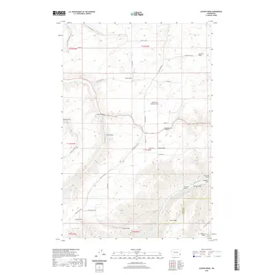
2020 Map of Alpowa Ridge
USGS Topo · Published 2020About this map
Alpowa Ridge and Darland Ridge dominate this section of the Inland Northwest, where deep drainages and high plateaus define the border between Garfield and Asotin counties. The landscape is characterized by a series of prominent finger ridges, including Valentine Ridge and Palmer Ridge, which overlook the agricultural bottomlands of the Pataha Valley. This area is a network of named gulches and canyons, such as Smith Gulch and Pine Tree Canyon, which channel seasonal water toward Pataha Cr and Alpowa Cr.
Find a feature on this map
44 named features on this map. Tap any name to fly to it.
Don’t see what you’re looking for? This feature index may not catch every label — zoom into the map to look around manually.
Map Details
Editions of this 2020 Alpowa Ridge Map
This is the sole edition of this map. No revisions or reprints were ever made.
Other maps of this area

1910 · Pullman
USGS Topo · 1:125,000

1937 · Pomeroy
USGS Topo · 1:96,000

1942 · Pomeroy
USGS Topo · 1:125,000

1943 · Peola
USGS Topo · 1:62,500

1946 · Peola
USGS Topo · 1:62,500

1950 · Penawawa
USGS Topo · 1:62,500

1955 · Pullman
USGS Topo · 1:250,000

1958 · Pullman
USGS Topo · 1:250,000

1964 · Kirby
USGS Topo · 1:24,000

1964 · Bishop
USGS Topo · 1:24,000