1971 Map of Alpowa Ridge
USGS Topo · Published 1974About this map
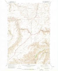
The settlement of Peola sits at the high southern reaches of this landscape, where the plateau begins its descent toward the deeply incised drainages of the Alpowa Ridge. This 1971 survey highlights a rural environment defined by its complex topography and the network of roads and trails that navigate it, such as Sweeney Road and Ledgerwood Road. Near the center of the map, the Philomathian School and an adjacent Cem reflect the community centers of this upland area. The drainage of Pataha Creek cuts through the western portion, while numerous named gulches like South Fork Deadman Gulch and Megginson Gulch carve into the ridges. The placement of Eureka Well and various borrow pits suggests the localized nature of water access and land use in this part of Garfield and Asotin Counties.
Find a feature on this map
40 named features on this map. Tap any name to fly to it.
Don’t see what you’re looking for? This feature index may not catch every label — zoom into the map to look around manually.
Map Details
Editions of this 1971 Alpowa Ridge Map
This is the sole edition of this map. No revisions or reprints were ever made.
Other maps of this area

1910 · Pullman
USGS Topo · 1:125,000

1937 · Pomeroy
USGS Topo · 1:96,000

1942 · Pomeroy
USGS Topo · 1:125,000

1943 · Peola
USGS Topo · 1:62,500

1946 · Peola
USGS Topo · 1:62,500

1950 · Penawawa
USGS Topo · 1:62,500

1955 · Pullman
USGS Topo · 1:250,000

1958 · Pullman
USGS Topo · 1:250,000

1964 · Kirby
USGS Topo · 1:24,000

1964 · Bishop
USGS Topo · 1:24,000