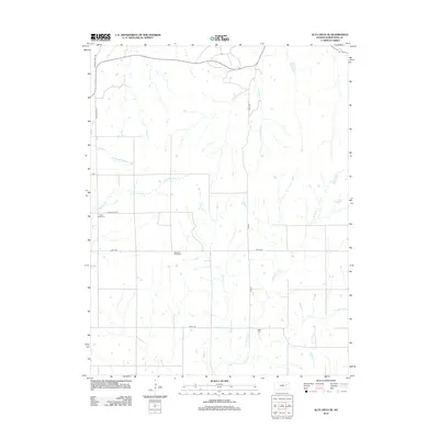
2012 Map of Alta Vista SE
USGS Topo · Published 2012About this map
The prairie landscape of Wabaunsee County is defined here by the intricate drainage of the Flint Hills region, where numerous creek branches like Middle Br Munkers Cr and E Br Munkers Cr begin their journey. The rural character of this Kansas territory is preserved through a sparse network of section roads such as Illinois Creek Rd and Chalk Rd, which trace the high ridges between the watercourses. Local heritage is anchored by quiet landmarks including Prairie View Cem and Pleasant Ridge Cem, situated on the open hillsides. The eastern portion of the map is dominated by the tributaries of Rock Creek, specifically W Br Rock Cr and E Br Rock Cr, illustrating the typical dendritic drainage patterns of the central plains at the start of the 21st century.
Find a feature on this map
18 named features on this map. Tap any name to fly to it.
Don’t see what you’re looking for? This feature index may not catch every label — zoom into the map to look around manually.
Map Details
Editions of this 2012 Alta Vista SE Map
This is the sole edition of this map. No revisions or reprints were ever made.
Other maps of this area

1885 · Eskridge
USGS Topo · 1:125,000

1889 · Eskridge
USGS Topo · 1:125,000

1894 · Eskridge
USGS Topo · 1:125,000

1955 · Hutchinson
USGS Topo · 1:250,000

1959 · Hutchinson
USGS Topo · 1:250,000
1971 · Allendorph
USGS Topo · 1:24,000

1971 · Alta Vista SE
USGS Topo · 1:24,000

1971 · Allen
USGS Topo · 1:24,000
1971 · Volland
USGS Topo · 1:24,000

1971 · Bushong
USGS Topo · 1:24,000